Fire rescue mostly occurs in chemical parks, shopping malls warehouses, community residences and other indoor places. With the continuous development of information technology, the UWB centimeter-level high-precision positioning technology system can accurately navigate and locate the real-time position of each firefighter in the fire scene. Realize front and rear coordinated rescue and remote command, accurately determine the risk factor of the fire scene, improve the commander's on-site command ability, and will inevitably reduce the casualties of rescuers.

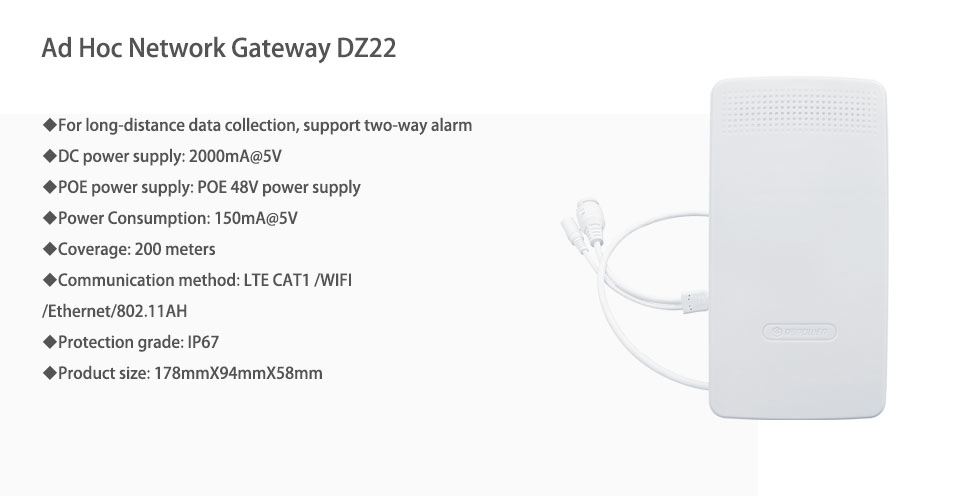
Ad-hoc network positioning technology, based on UWB TWR two-way ranging, abandons the original multi-base station layout scheme, uses mutual ranging between tags to establish location topology, and analyzes coordinates in the base station part.
In order to realize the conversion from relative position to absolute position, the Beidou high-precision positioning module is usually installed in the positioning base station, and three ranging tags relative to the known coordinates of the base station are installed as the position initialization reference.

The system adopts 1+N method, 1 central node (vehicle remote receiving base station) + N positioning tags (carried by rescuers).
The central node function is mainly used for command and dispatch to obtain the positions of all positioning labels.
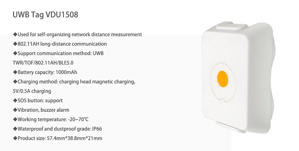
The positioning tag adopts the AI self-organized network method, self-learning, and mutual distance measurement with the three nearby tags, and transmits the distance measurement information back to the central node.
In addition, after the positioning tag triggers the distress mode, it can notify the central node and three nearby tags to come to the rescue, and the tag that receives the distress message can measure the angle and distance of the alarm tag in PDOA and TWR methods, and then go to support.

The base station is equipped with Beidou high-precision positioning module, which can update its absolute position in real time. The surrounding three fixed-point tags can be fixed around the base station. For example, if you put it on the car, you can follow up the positioning tag in real time to obtain the best positioning effect.
The static accuracy of Beidou positioning is as high as 10cm, and the accuracy of UWB ranging positioning is also 10cm. The combined accuracy can achieve a circular error of 20cm. The dynamic accuracy is related to the ranging frequency of the tag and the background processing speed. Generally, the accuracy within 50cm can be achieved.
UWB is a communication technology in the medium and short distance range, which is very suitable for building a real-time positioning system in an indoor environment. At present, the coverage distance of the standard power UWB base station can reach 100 meters without blocking. Extended power, such as the power under the coal safety standard, can achieve a coverage of 1 km.
UWB signal has strong penetration when using low channel CH2 (3.9936GHz), and the penetration is between 2.4G WiFi and 5G WiFi. UWB signals can pass through concrete, glass, wooden boards, etc., and can maintain good signal integrity. It is less affected by the medium, and its spatial transmission model is ideal. Therefore, the coordinate position accuracy calculated based on this model is ideal.
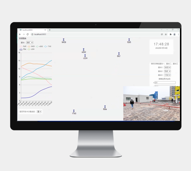
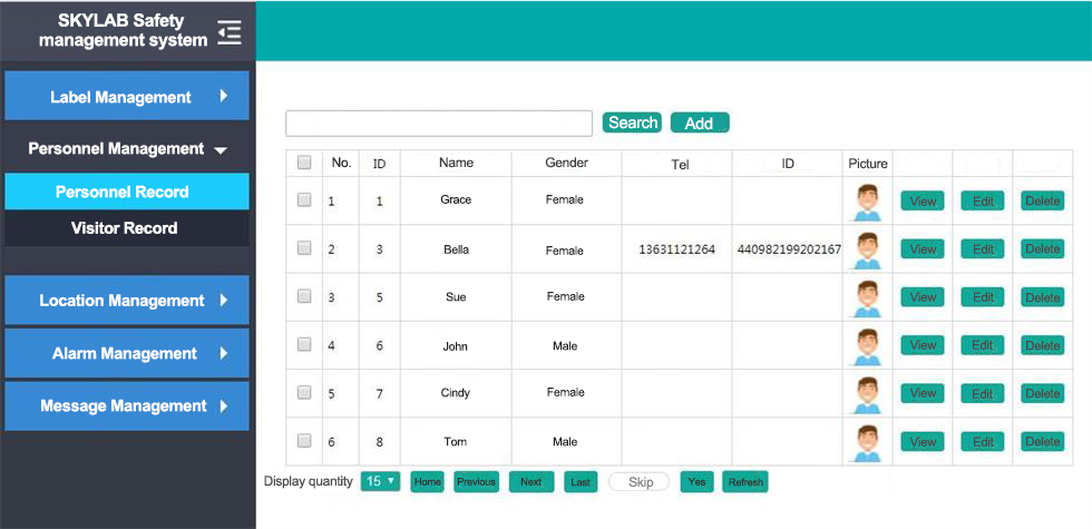
At the rescue command site, the real-time location of rescuers can be checked at any time in the background of the system. As well as personnel distribution, personnel dynamics, number of personnel, and specific personnel in the area. You can also query the historical distribution of personnel, so that managers can grasp relevant information in a timely manner and ensure personnel safety.

The system automatically records the historical activity trajectories of personnel. Entering personnel information can view the historical activity trajectories, walking routes, time in and out of a certain area, and length of stay in a certain area of the relevant personnel at the rescue site, which is convenient for supervision and management and optimizes the rescue process.
Separate this area by setting up electronic fences in the hazardous area. If a person approaches or enters the area, stays overtime, or stays still for a long time, the system will send out an early warning message to carry out real-time early warning to remind the command department to pay attention to the safety of rescuers. As shown in the figure below, you can add an electronic fence in the background of the UWB personnel positioning management system to check whether there are people crossing the electronic fence in real time.
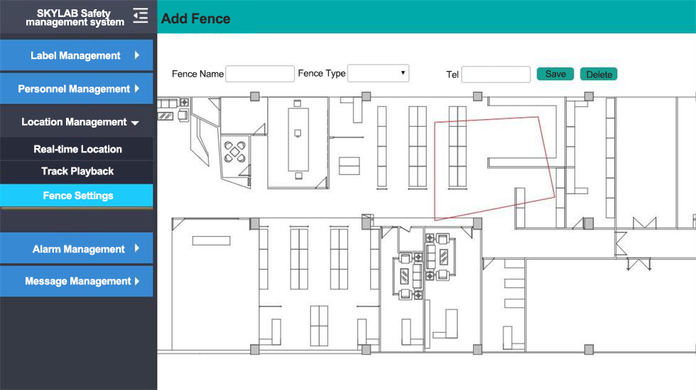
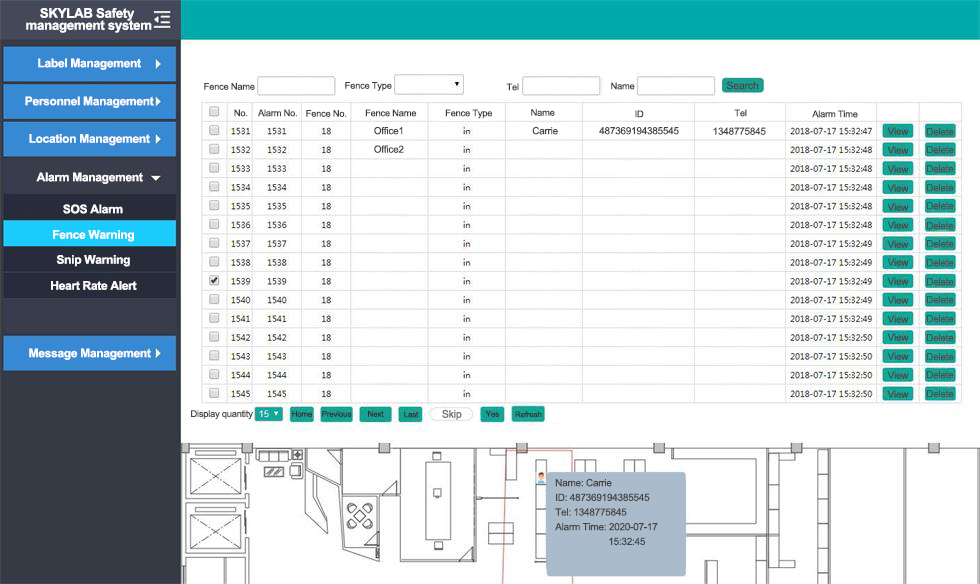 staff positioning management system-electronic fence warning
The intelligent positioning tag hardware developed by SKYLAB, such as UWB wristbands, badge-type tags, etc., have integrated one-key alarm buttons. Once the rescuers are in danger or need assistance, they can press the one-button alarm button to notify other personnel to come to rescue. The management personnel can carry out rescue according to the location for help, improve the efficiency of safety rescue, prevent the situation from worsening, and ensure the safety of firefighters.
By placing a large LED display screen in the rescue command area, you can customize the relevant data to be displayed. Such as the number of rescuers in the fire area, the location of each person and other information.
To learn more about UWB positioning solutions please contact SKYLAB authors
Prev:Bluetooth AOA indoor Positioning System Solution
Next:Asset Management UWB and Bluetooth Positioning Solution
Copyrights© Shenzhen Skylab Co.,LTD All Rights Reserved.

