Making Wireless IoT Project Easy, Smart, Secure.
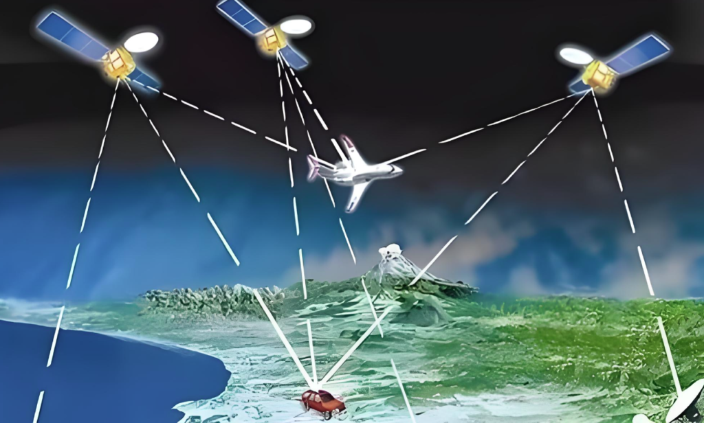
GET A FREE SAMPLENavigation enhancement technology plays a crucial role in modern satellite navigation systems. It is like a "booster" for satellite navigation, which can greatly enhance the service capability of the system. The information augmentation system is like a precise "data analyst", analyzing satellite data through ground monitoring stations, calculating error correction or integrity information, and then transmitting it to users through space-based or ground-based communication links. This method provides users with more accurate positioning services without changing the existing satellite navigation signals. Signal based augmentation systems, on the other hand, are more like "strong partners", with their navigation augmentation sources capable of generating ranging signals that can be used in conjunction with existing GNSS signals for joint positioning, further enhancing the availability, reliability, and continuity of satellite navigation services. Both information-based and signal based enhancement systems can be divided into two methods: ground-based enhancement and satellite based enhancement, providing diverse choices for different application scenarios.
The Development History of Navigation Enhancement Technology
1. The birth of differential GPS (DGPS) technology
In the early days, the availability policy of GPS selection in the United States brought certain positioning accuracy problems to users. To address this challenge, differential GPS technology has emerged. It cleverly utilizes the geometric similarity between the reference station and the user, effectively eliminating common measurement errors and greatly improving the accuracy of pseudorange positioning through the method of pseudorange difference between measurement stations. It's like finding a more accurate course for a ship in the vast ocean.
2. Breakthrough in Wide Area DGPS (WADGPS) Technology
However, DGPS requires the deployment of a large number of reference stations for large-scale enhancement, which has certain limitations in practical applications. To solve this problem, wide area DGPS technology has emerged. It innovatively uses geostationary orbit satellites to broadcast GPS and other navigation satellite correction products, not only achieving a positioning accuracy of about 1-3m, meeting the strict requirements for accuracy in the aviation field, but also providing safe and intact services. When GNSS encounters abnormalities or malfunctions, it can detect and alert users in a timely manner, like a loyal guardian.
3. The advantages of Real Time Kinematic (RTK) technology
Real time dynamic positioning technology goes further by eliminating the majority of common biases related to propagation paths and satellite orbit clock errors through the difference in carrier phase measurements between users and reference stations. This enables it to achieve instantaneous centimeter level positioning, bringing revolutionary changes to high-precision measurement, engineering construction, and other fields. It's like installing a pair of 'precision eyes' for precision engineering.
PPP-RTK precision single point real-time dynamic positioning technology
1. The emergence of non differential positioning system PPP
With the continuous development of satellite precise orbit determination and clock bias estimation technology, as well as the widespread application of carrier phase observations, various error models have also been refined. On this basis, the non differential positioning system PPP emerged. It is not limited by inter station distance and can provide users with high-precision services ranging from decimeters to centimeters over a wide area, like opening a door to the world of high-precision positioning for users.
2. PPP-AR technology improves accuracy and reliability
However, PPP is not perfect either. Due to various hardware delay biases, its ambiguity is usually only estimated as a floating-point constant, and its accuracy and reliability still need to be improved. In order to solve this problem, carrier phase decimal deviation estimation separation technology and non difference ambiguity fixing technology have been developed, achieving PPP ambiguity resolution (PPP-AR). This significantly improves the accuracy and reliability of understanding, providing a more solid technical guarantee for high-precision positioning.
3. PPP-RTK technology achieves fast centimeter level dynamic positioning
In addition, in order to solve the bottleneck of long convergence time in PPP, precise single point real-time dynamic positioning (PPP-RTK) technology based on regional dense ground station atmospheric information enhancement has emerged. It can achieve fast centimeter level dynamic positioning for one minute or even seconds, providing powerful technical support for real-time dynamic monitoring, autonomous driving and other fields.
Satellite based augmentation services of the Beidou system
1. Innovative Design of Beidou System
The Beidou system has a unique insight in top-level design, incorporating satellite based enhancement into its six major services. Unlike traditional navigation enhancement information transmission methods, the Beidou system broadcasts various enhancement information required for SBAS and PPP through navigation signals from GEO satellites in the GNSS constellation. This innovative measure significantly improves the positioning performance and convenience of users in China and surrounding areas, bringing users a brand new experience.
2. International development of satellite based enhanced services
Japan's QZSS is also not willing to fall behind, and based on its L6D signal, it has implemented the Centimeter Level Augmentation Service (CLAS) for satellite based PPP-RTK. Currently, satellite navigation systems such as Galileo and GLONASS have also proposed to broadcast high-precision augmentation services on a unified satellite navigation system platform. This indicates that star based enhanced services have become an important trend in the development of global satellite navigation systems.
Future prospects of navigation enhancement technology
The development prospects of navigation enhancement technology are bright. With the continuous advancement of technology, we can foresee that future navigation enhancement technologies will become more intelligent, efficient, and precise. For example, the application of artificial intelligence and big data technology will further improve the calculation accuracy and speed of error correction, providing users with more real-time and accurate positioning services. At the same time, the development of new communication and satellite technologies will also provide broader development space for navigation enhancement systems. In addition, navigation enhancement technology will be deeply integrated with more fields such as intelligent transportation, autonomous driving, precision agriculture, etc., playing a greater role in promoting the development of the social economy.
In short, navigation enhancement technology, as an important component of satellite navigation systems, is constantly driving satellite navigation services to a higher level. Its development will bring more convenience and surprises to our lives, let's wait and see.
Prev:Analysis of indoor and outdoor integrated positioning scheme, GNSS/UWB/BLE positioning technology
Next:A high-precision positioning management solution for warehouse storage based on UWB technology
Copyrights© Shenzhen Skylab Co.,LTD All Rights Reserved.


